
Long Drive:
It was about 1370 miles from my home in Washington to Lake Havasu, Arizona. We drove down I-5 almost to Bakersfield, then cut over to 99, then took Highway 58, I-40 and Highway 95 to Lake Havasu City. Yes, I did my homework - repacked the bearings, replaced the leaf springs, checked all bolts, tires, and all of that trailer stuff, along with making sure the boat was ready to go. The trip down was uneventful - long, maybe a bit boring, but we were blessed with good weather (e.g. No snow!). As we crossed into California, it was very nice! Sunny, and we could shed some layers. It took us about 2 1/2 days to drive down. We got to the Lake Havasu Marina about dusk on Friday, got our slip assignment, launched the boat and motored over to the slip. There were already a number of other convention attending sailboats at the marina - we got a chance to meet some and chat a bit, before heading off to do some provisioning, get some dinner, and turn in for the night. The marina allowed convention attendees to sleep on their boats.
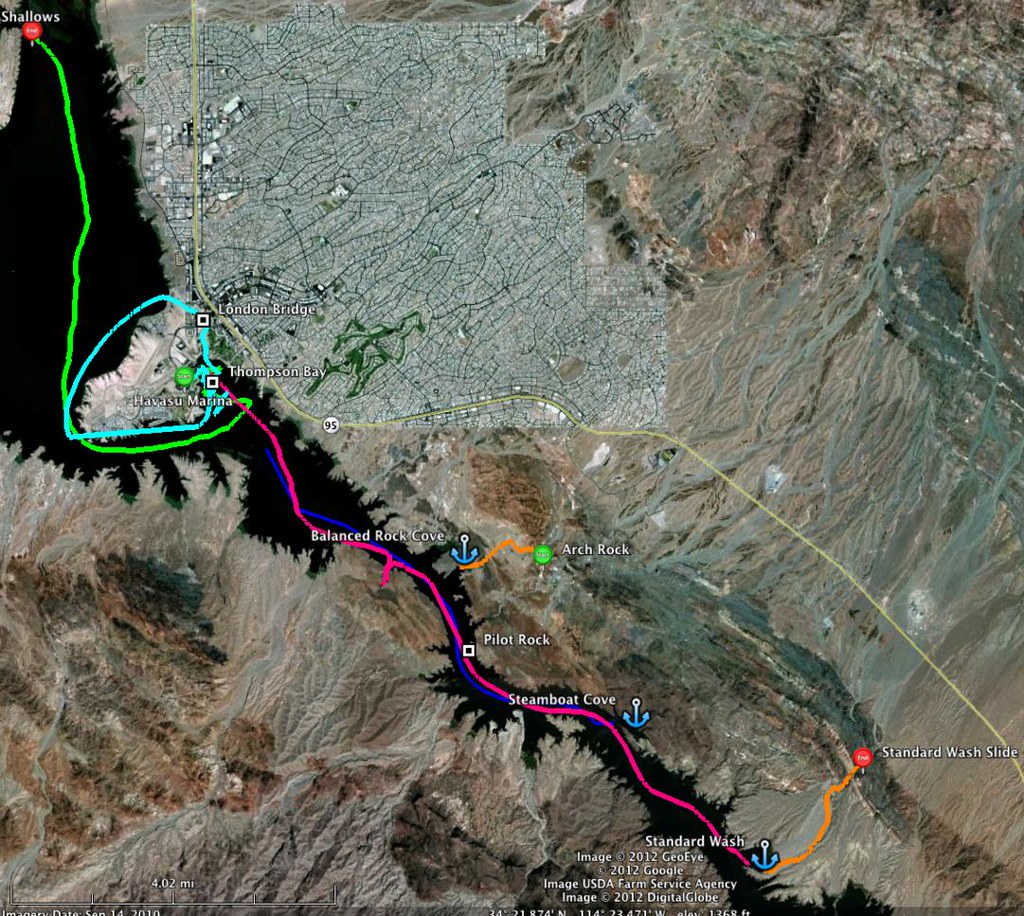
Below is a map of the Lake Havasu area that we sailed (Note: map is 1081 pixels wide. You might need to widen your browser to view the whole map):
Saturday Feb 11: Sailing at Lake Havasu
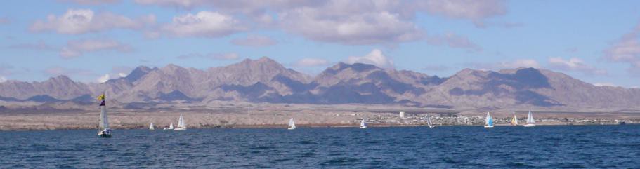
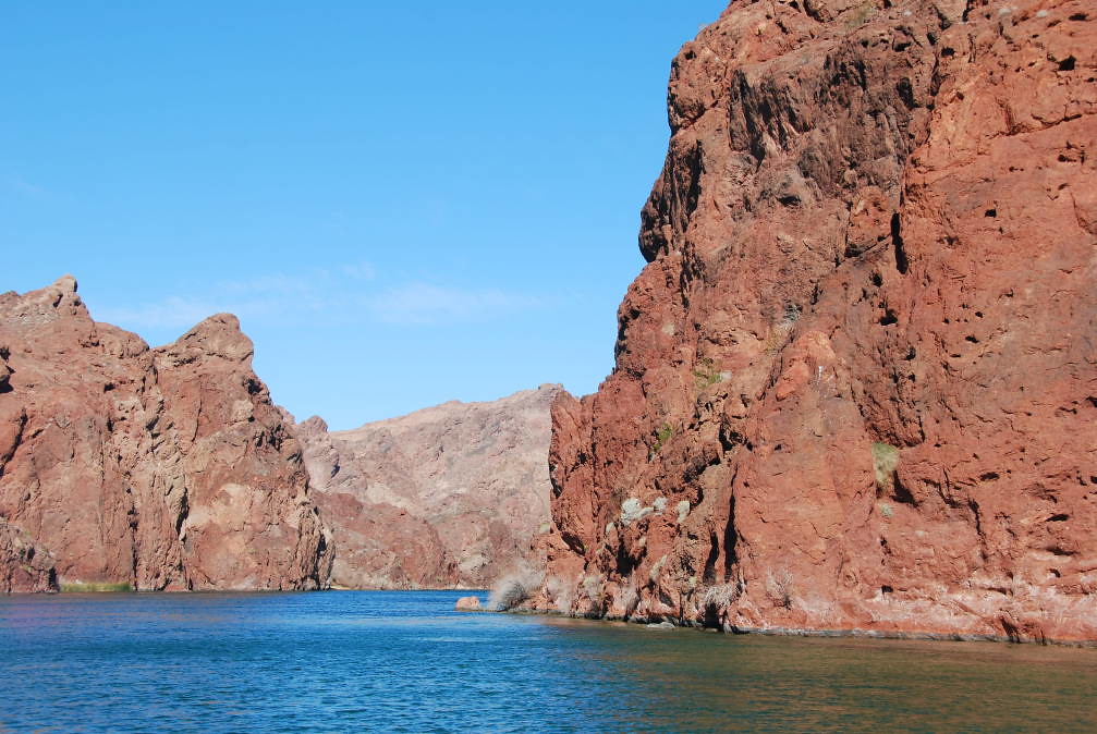
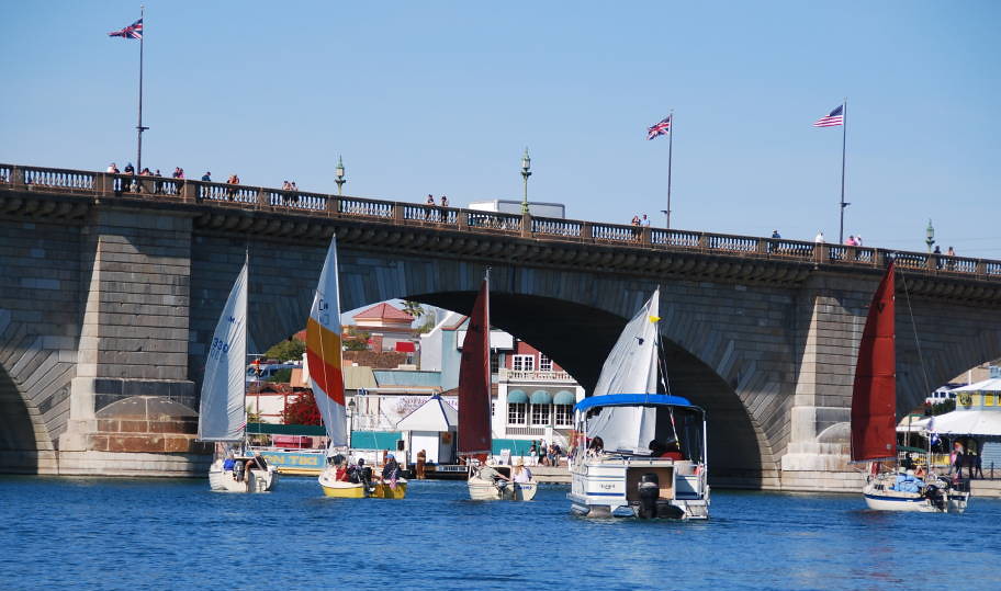
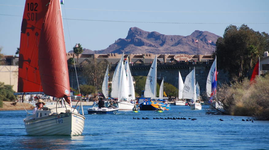
We slept in - maybe recovering from all that driving? We came to sail, so we motored out of the marina, and sailed west, and around the island (light green route on the map). The winds were pretty steady, from the south, about 15 kts, so it was a very nice reach and a run up the lake. We had good winds and not very much chop, and we could make 4-5 knots most of the way. We sailed north, to the "shallow" area, where Lake Havasu is more like a river. We tried to gunkhole our way into the shallows. North about 10 miles is the Topock Gorge, which is a very scenic part of the lake. After bumping the soft bottom a bit, and with the wind, we decided to give up. So we sailed south toward the London Bridge - figuring we'd test, to make sure we could go under (stated clearance is 34.5 feet, so we should be fine). We were able to clear with room to spare. But we ran into another problem - the channel was closed! They were having a model hydrofoil race - We got hosed by the power boats!. Oh well, a good excuse to keep sailing (we found out later that they open the channel briefly between heats). So we did have a good sail back around the island - still able to do 4-5 knots with maybe 15 knots of wind. We made it back to the marina by 6pm, as the sun was setting. The GPS said we covered 21.5 NM today.
Sunday Feb 12: Sailing south to Steamboat Cove
More HPCC'ers arrive, so we spend some time getting to know folks from all around. This is great! One of the "early bird" HPCC activities is a BBQ at Steamboat Cove, about 6 miles south of the marina. So Today, we sail south - the Blue track on the map. We left the marina about 11am. The winds were from the south and fairly light, so we slowly beat our way south. But the scenery is fantastic! Rich browns and reds, in the rocks and landscape. This is desert country - something us western Washingtonians aren't used to! The land south of Lake Havasu City is mostly Bureau of Land Management land or Native land, so there isn't much development. There are a few resorts sprinkled here and there, but this is the off season, so it seems pretty deserted. I guess we are kind of die hard sailors - we keep sailing, while others motor on by. Steamboat Cove is pretty sheltered and a great place to explore. Here we are, arriving at Steamboat Cove - there are already a lot of boats there:

We end up getting there about an hour late - There's still lots of food, but many are leaving to head back to the marina or the London Bridge Resort (many folks came only for the day). But there is a good number of boats who stay the night, as we did. We met Rick and Lee, who also own a SJ21. The food is great, and we get to know a bunch of other cruisers, from all over. We talk about boats, cruising, and more. This is great! Since many of the boats left, there is plenty of space to beach the boat, so we decide to bring the boat in. Nice beach, but I'm not sure I like the scraping, crackling, sandy beach noise I hear, when the boat tips or shifts. The sunset is beautiful - it really brings out the reds in the rocks. The GPS indicates we sailed 9.5 miles, to go 6 miles - that's beating!
Monday Feb 13: Sailing north to Balanced Rock Cove, then to the Marina
Today we woke up earlier, had our breakfast, and found many people are leaving. We were about the last to leave, at about 10am. The wind is from the south, so it is going our way - looking forward to a nice run! Rick and Lee, with the SJ21, leave just before we do - they launch their spinnaker - inside the cove! Wow, and they gotta do a quick gybe near the entrance marks to avoid the rocks. Here is a shot of them tearing out of Steamboat Cove, probably doing 6+ knots!

We are a bit more cautious - we sail out under main and genoa, clear the rocks at the entrance, and then launch the spinnaker. By then, Rick and Lee are probably a mile ahead of us. Looking at the GPS, it is showing a consistent 6.3+ knots, and I noticed peaks of 7.4 knots! We did get our exciting run:
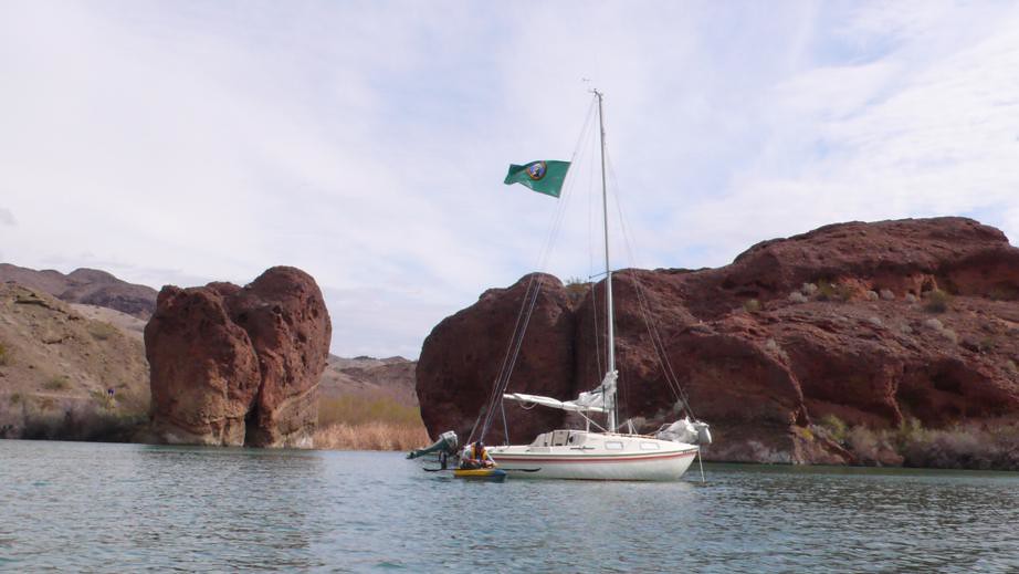
The miles go by quite fast when you are on a good run! We sail north with another HPCC'er, in a Montgomery 15 - with a Gaff Rig! Very nicely done. It didn't take very long for us to get to Balanced Rock Cove - our stopping point for the afternoon. Wait -its still morning! We made good time. The plan was to hike up the desert wash to the slot canyon ( Here is a description, coming from the road: http://www.desertusa.com/mag06/sep/sara-hike.html ). We sailed in, and set the anchor - under sail.
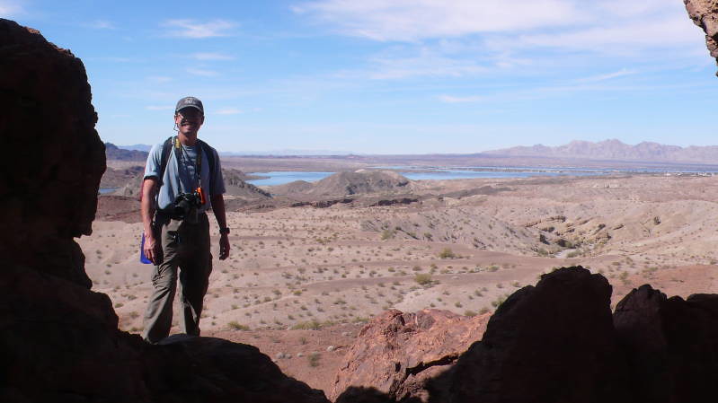
We inflate the kayaks, make lunch, and get ready for our first desert hike of the trip. We go ashore, pay our fee, and start hiking up the wash. We meet other hikers, from all over the country. Many, like us, are escaping the cold weather and enjoying the warm desert in February, before it gets really really hot. The slot canyon is pretty spectacular - it is quite narrow at places. Our path is the orange path from Balanced Rock Cove to Arch Rock, but we continue on to the slot canyon, just beyond the Arch.
We did get to the famous slide. We were coming from the water, so we went up the slide first. It was a nice hike and the weather was perfect - mostly sunny, but not too hot. After lunch, we slid down the slide, on our way back to the boat. Interesting desert flowers. Looks like there's been a bit of rain recently - we can see some new growth. After arriving back at the boat, we weighed anchor, cleaned off the mud, then sailed back to Lake Havasu Marina. The run was short, so I was lazy and just ran back on the jib. But, we were doing 5-6 knots according to the GPS. Today's total - Steamboat Cove to Balanced Rock Cove, and then to Lake Havasu Marina was 7.6 NM according to the GPS. Tonight, we get to check into the Nautical Inn, and get a shower! And sleep in a real bed! Now this is cruising! We also went to the convention center, registered, and met a whole bunch of people.
Tuesday Feb 14: Ruddercraft Long Distance Race
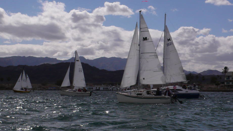
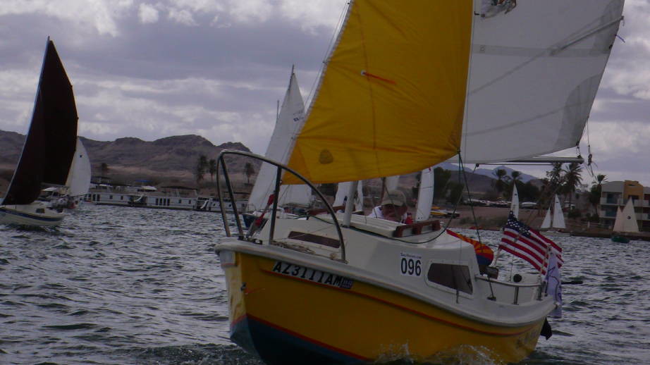
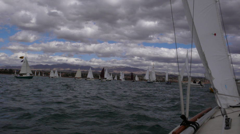
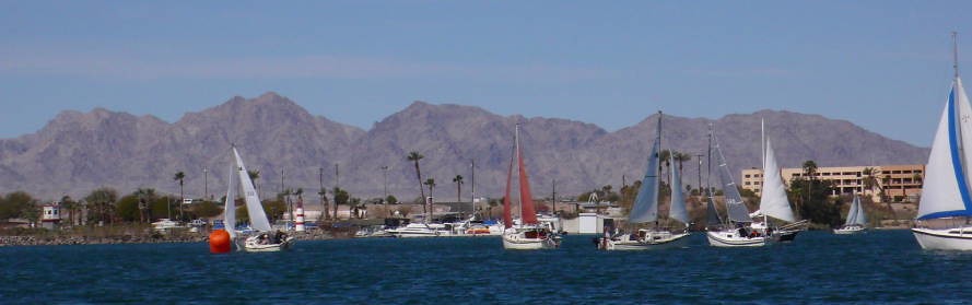
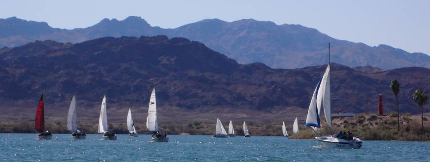
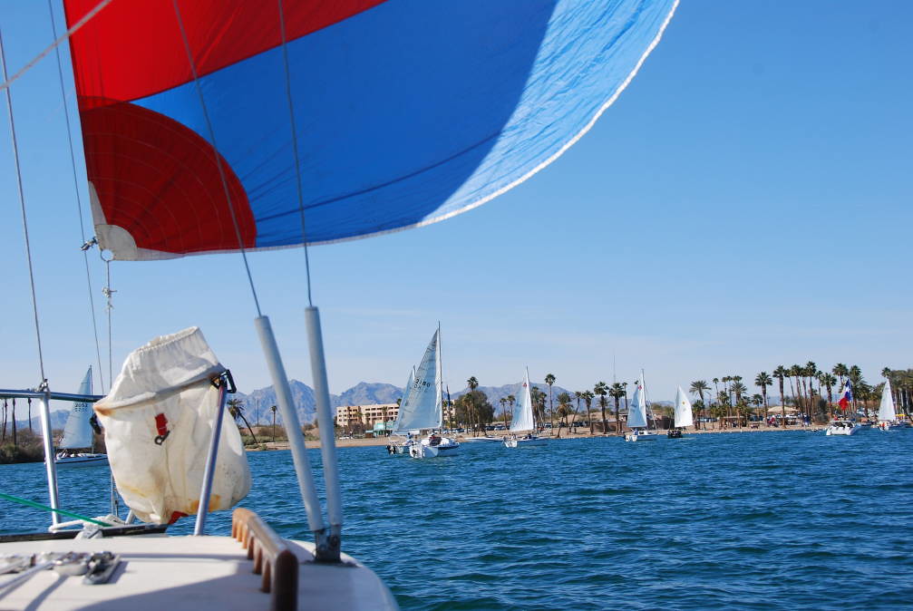
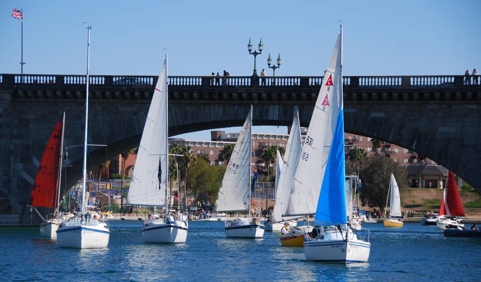
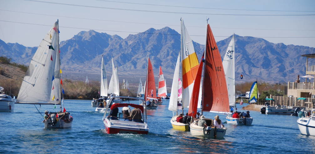
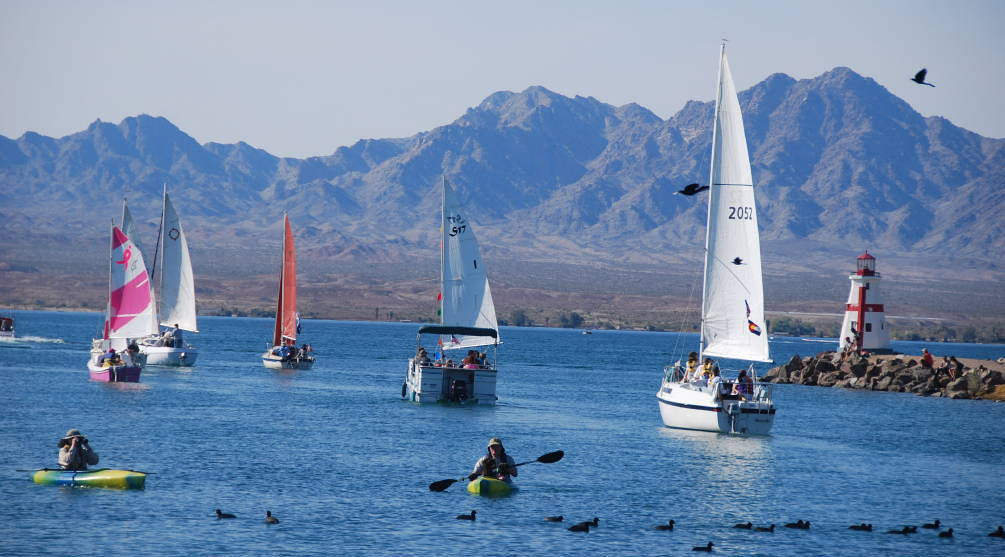
Today is the first HPCC sailing event - a long distance PHRF race - about 13-15 miles. The event is sponsored by Ruddercraft. They do make SJ21 rudders - and they are very nice! Today, the winds are from the North, and are forecasted to be light. The race is kind of like a cruise: Starts at Thompson Bay (near the marina), then around the Island to mark north of the Channel, then back around the island, to a mark near Grass Island, then back to the start. This race has a single start - all boats start together, warning horn at 11am. So, after the meeting, we head for the boat, get ready, and head out. Most cruisers do not have spinnakers, so spinnakers are not allowed in the HPCC races. We put on the 130% Genoa, figuring light winds. As the start approaches, the wind is picking up! There are a lot of boats out here - over 100 boats is my guess. The start line is fairly long. Not all are racing - some are just out for a sail and/or taking photos.
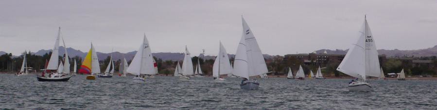
This is kind of fun! We manage to get a pretty good start, and are near the head of the pack (to be fair, these are cruisers, and many are not used to racing starts, and many waited till the crowd thinned out before starting). The reach around the island is pretty good - we are making 4-5 knots and staying near the leaders, except the multihulls who are trouncing all of us. There are wind shifts and gusts. We probably had 10-12 knots with puffs maybe 15 knots, much more than the forecasted 3-5 knots. We botched a couple of tacks on the beat and let a Sage 17 pass us (how embarrassing! Later to learn Jerry Montgomery, the designer, is at the helm, so I don't feel quite as bad). The wind is good north of the island, and we round the mark, and turn downwind, to head back around the island.
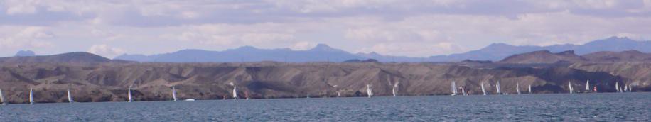
It was a fairly quick broad reach, then around the Grass Island mark, and a beat back to the finish. By now, the wind had really picked up. We chose the east side - the Sage 17 chose the west side. We managed to pass the Sage on the beat, but of course, we owed him a lot of time, so in the end, he beat us. We got some really good lifts sailing around the island, and on the beat. The sailing was great! And the scenery was great too. After we finished the race (our time was 3:01:34 but got corrected to 3:11:44) , it was still blowing pretty good, and it was early in the day, so we decided to keep on sailing. Since we weren't racing anymore, and had beat our way upwind, we decided to launch the spinnaker an sail downwind, carefully avoiding the boats still working to finish the race. We got some good photos of other boats too. We ran down to Grass Island, then beat back up to near the finish line. Then, we launched the spinnaker again, ran down past Grass Island. Finally, we beat back upwind, dropped the sails, and motored into the marina. The GPS indicated we sailed 25.9 NM today. We ended up finishing 10th out of about 100 boats, after corrections. We got to talk to another SJ21 owners: Tony and Lee Ann, from Idaho. We all had a great time - what a great day for sailing.
Wednesday Feb 15: Pocket Cruisers Cup
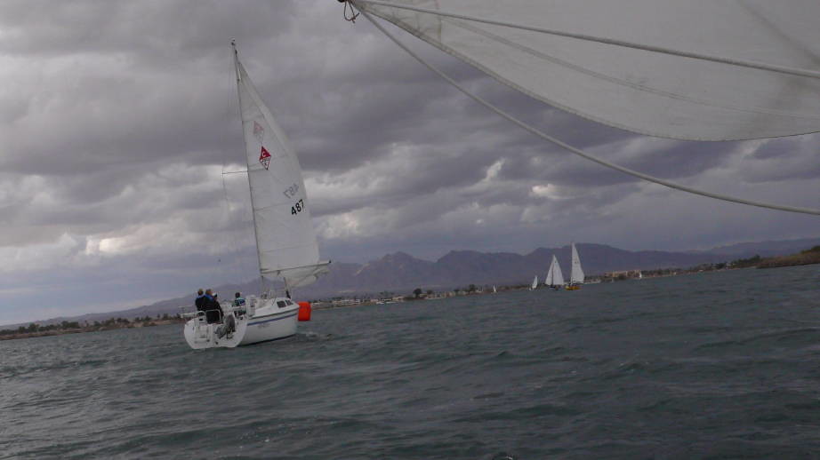
Today is the Pocket Cruiser's cup race. This race is divided into small, medium and large boats. Large is defined as over 19 ft, so the SJ21 gets grouped with the Catalina 22's, 25's, Macgreggor 26's, etc. But there is still a single, long starting line - everybody starts the same, and runs the same course. Today's race is a bit shorter. Winds are forecasted from the southwest, in the 15-20 knot range, with gusts to 26!
The course is shorter - Thompson bay, to Grass Island, and back - about 9 NM. As we approach the course, we can see whitecaps forming. We play it safe and fly the jib, but no reef in the main.
Today, we got an OK start, but did pretty well in the beat to windward, keeping up with a lot of the bigger boats, and passing a few - many had reefed mains.
There were some pretty good gusts, and I got caught off guard and took on a bit of water into the cockpit - first time in a long time. We stuck it out, beating to the windward mark, and did some fancy maneuvering to make it around the mark (a Cat 25 following us complimented us - he didn't think we'd make it around the mark!). I guess a bit of experience helps. On the run, we see Tony and Lee Ann on the other SJ21, beating to windward:

Later, they told us they were having a great time. On the downwind run, we were doing battle with a Catalina 25, sailed by a family from Flathead Lake, Montana. We'd pass them, and then, they'd pass us. Here they are, just approaching the gybe mark, after passing us.
We had our jib out on a whisker pole, so we were slightly faster, most of the time on the run. They did not have a pole. As we passed them, we noticed they had a reef in their main. We yelled: "Shake out your reef!". You could see the wheels turning, and some discussion. Soon, their reef was out, they slowly went by us. They were excited! We somehow managed to keep up with them, and get back up with them on the beat, but they beat us to the finish by about 2 boat lengths. Oh well, I guess that's what I get for giving advice! Still, it's kind of fun to help make someone else's day. We ended up finishing 8th out of 16 "Big" boats. I found out later that this race was not handicapped. Still, it was a great day for sailing. We took the sails down and motored into the marina. Shortly after we arrived, a thunderstorm approached and it started to rain hard. Just before it hit us, I heard someone on the VHF caution all the boats to get in quick - its going to get ugly fast. I was glad to be at the dock when the cloudburst hit. But then, it didn't last very long, and 30 minutes later, it was clear again.
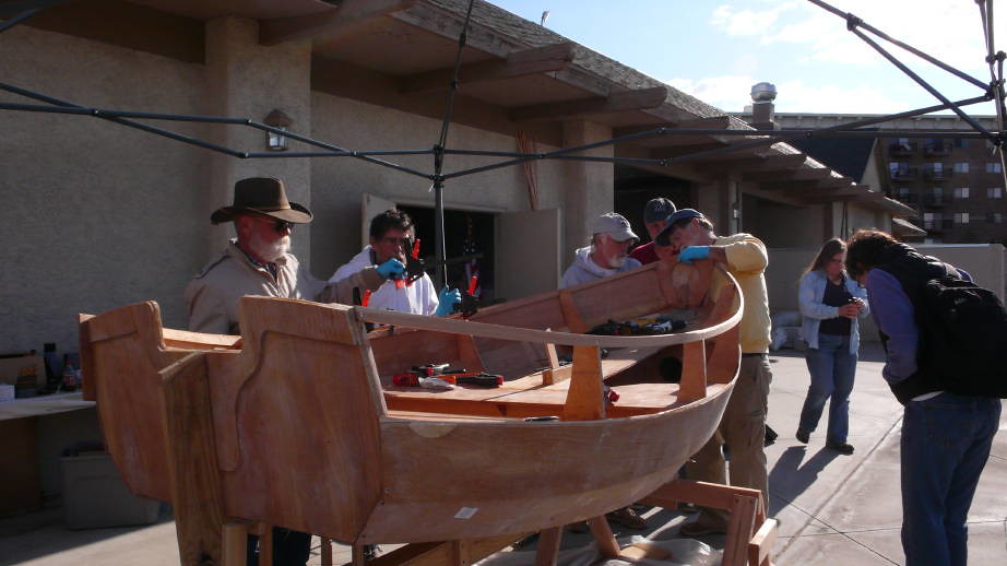
Thursday Feb 16: Seminars: Multihulls, Sail Trim, Sherpa Sailing Dinghy build
Today, there were a lot of seminars scheduled. Winds were predicted to be 20-30 kits with gusts to 40 - maybe a bit less at Havasu, but we did see a lot of whitecaps in the north and some in the south. We decided it was a good day to take in some seminars.
A couple of the guys were building a Sherpa Sailing Dinghy for the Havasu Sea Scouts. It was quite impressive - in a week, they got the whole thing done - the only thing it needed was paint.
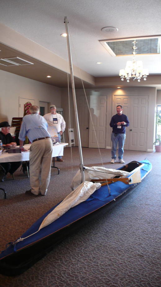
Another seminar was given by a man who had sailed a kayak like this one around cape horn. He told of his adventure and the people he met. It was quite a story.
After lunch, we took a bike ride around the Island, stopping at a lot of the lighthouses we keep seeing from the water. Now, we can check them out from the land! The wind was pretty strong. We played tourist today - walked the London Bridge, checked out the seawall, shops, attractions, docks, etc. That evening, there was some evening entertainment and activities at the Mudshark. It was a good opportunity to rub shoulders with folks, and talk boats, cruising and have fun. Wow! I got lucky - I won a Spyderco knife as a raffle prize.
Friday Feb 17: Manufacturers' Cup Races
Today, the races are sponsored by the boat Manufacturers: Mongomery, Potter, and MacGreggor (the corresponding manufacturer pays for the trophies, and running of the races). So today, we are not racing. But, we can watch, and take pictures. So we headed out to Thompson Bay to watch the MacGreggor race, and got a few photos:
Earlier in the week, after running aground while attempting to head north toward Topock Gorge, we found out there is a tour boat that takes tours up that way. So we decided to take the afternoon tour, see the Topock Gorge, and leave the driving to someone else! While we were heading north, out of the channel, we catch the tail end of the Potter manufacturer's race, which is being held north of the island - the windy section! This Potter sure looked nice running south in the channel, toward the bridge:

The Topock Gorge has some pretty spectacular rock formations, washes, and wildlife. It was a great trip, and the guides were great at spotting wildlife, and giving everyone a good view.
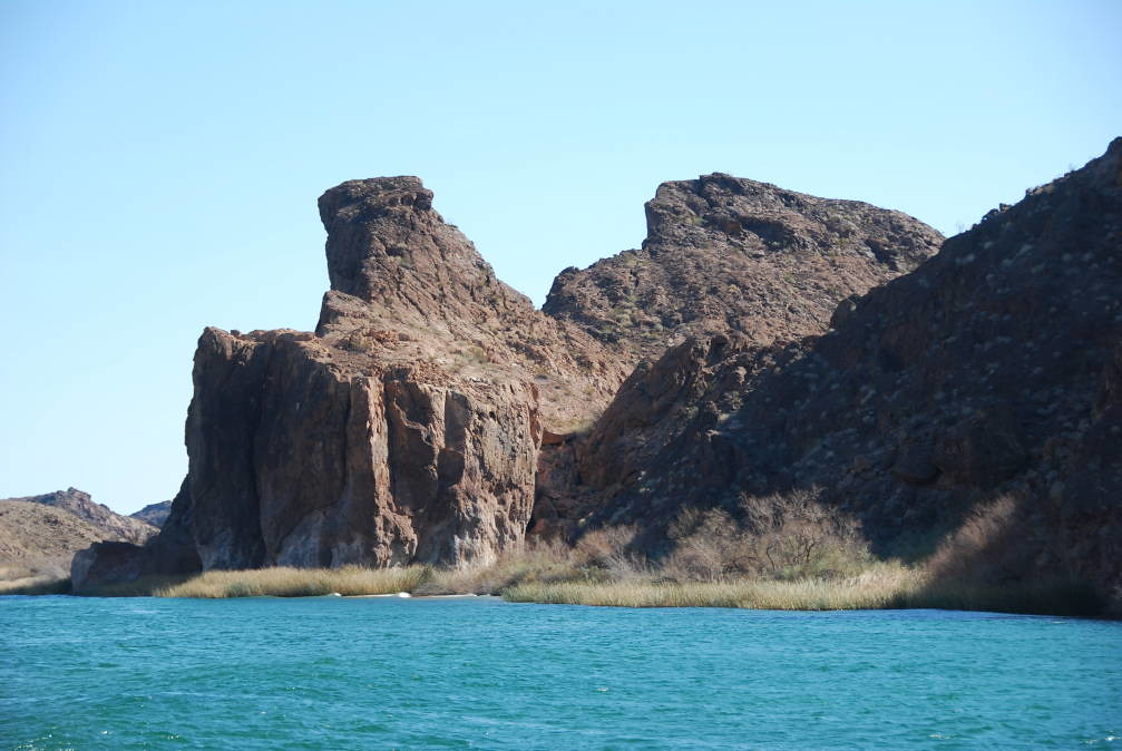
Some of the narrow sections were quite spectacular, with interesting rock formations and lots of color. I'm glad someone else is doing the driving today, so I can enjoy the views, and take photos! I spent most of the trip outside, on the back deck of the tour boat, enjoying the scenery, enjoying the great weather, and taking photos.
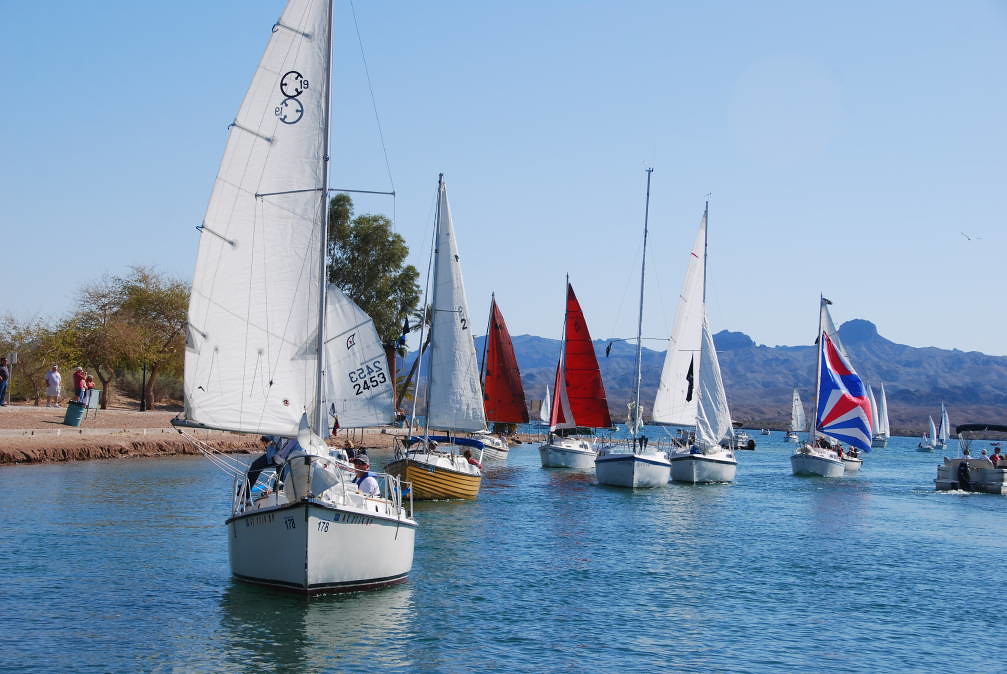
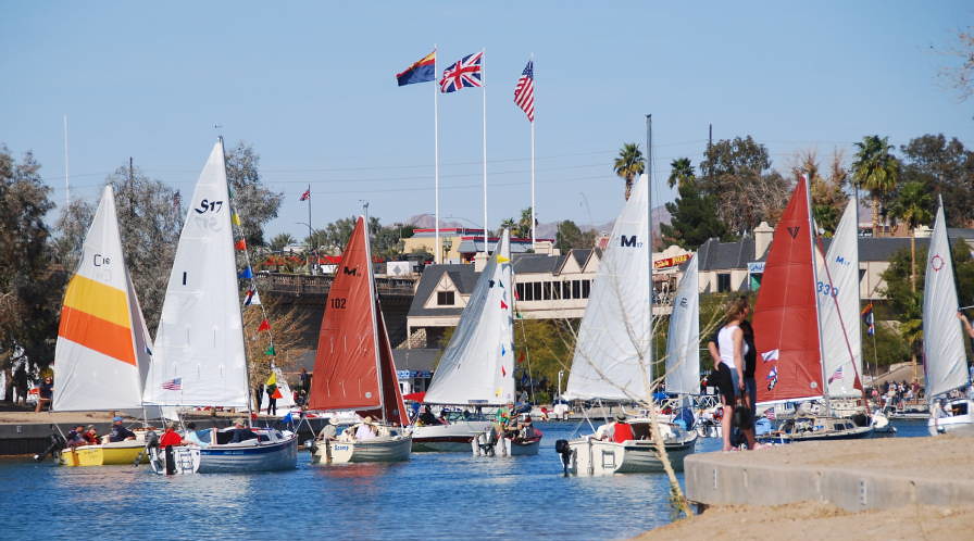
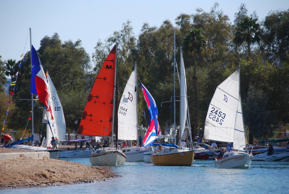
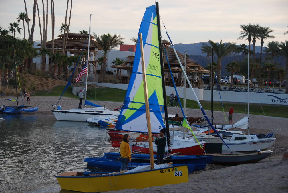
Saturday Feb 18: Boat Show at the London Bridge Resort Docks, and Parade of Sail
Today's the big day, for the Boat show and the Parade of Sail. The boat show is in the morning, and the public is invited. The docks are filled with pocket cruisers of all kinds, and overflow is accommodated on the sea wall.
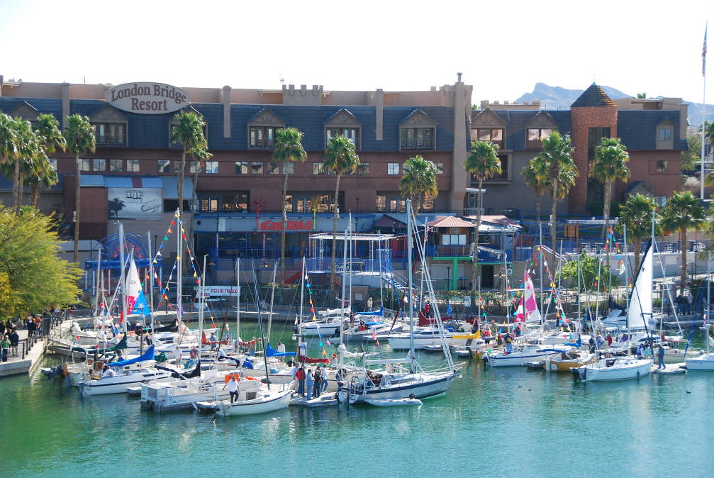
I end up chickening out - not really wanting to put my boat on the sea wall. But it sure was fun to walk the docks and talk to owners. Lots of excitement, great ideas and experiences shared. Maybe next year, I should get a room and a slip at the London Bridge Resort.
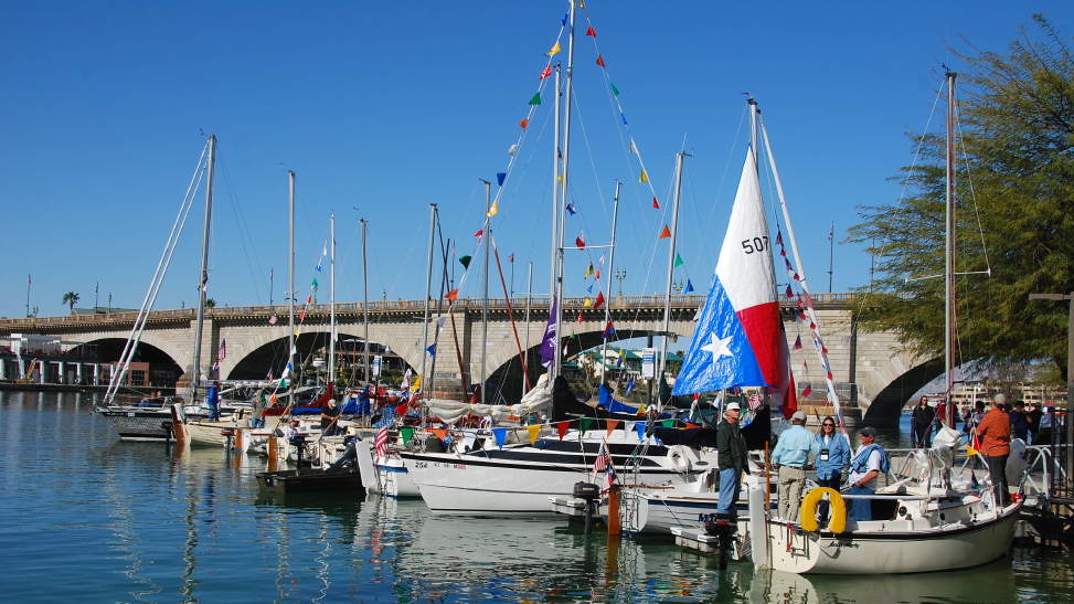
Finally, the time comes to break up the Boat Show. Everybody starts to get ready for the great Parade of Sail. Sean Mulligan leads the parade, in his Montgomery 23. The parade is downwind. Today, the wind is from the south, so we all gather in Thompson Bay, just south of Bridgewater Channel. That's perfect for us - its just outside the marina.
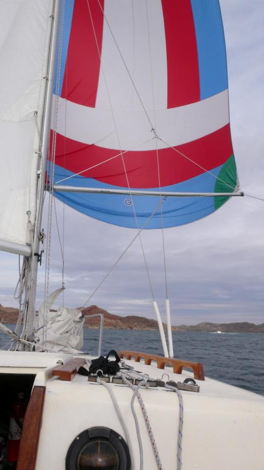
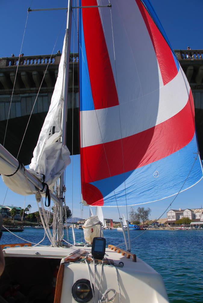
We decide to fly the spinnaker off the forestay, like a big genoa - my spinnaker is a 'cruising' spinnaker, with hanks at the head and tack to clip onto the forestay. And we drop the main most of the way -leaving just enough to show the SJ21 logo. I figure with the spinnaker, we don't need any more sail area - we don't want to run over everyone!

No real organization needed. People just fell into a line, kind of, reasonably orderly. There were a few unruly powerboats, milling about, and going the wrong direction, but overall, things went well. I'm sure it was quite a sight from land, watching all the boats sail by.
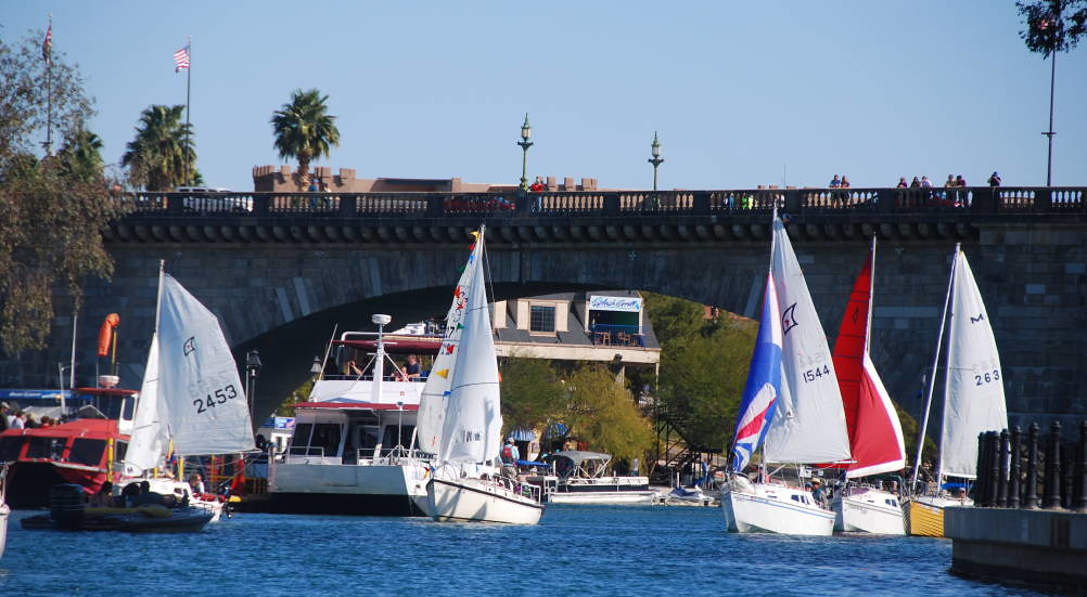
We're approaching the London Bridge. The Flags are flying high. What a great day!
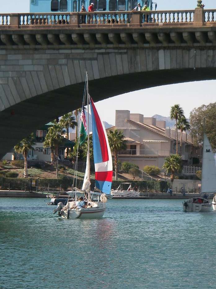
OK, it is our turn to sail under the bridge:
A fellow HPCC'er took this photo of us, sailing under the bridge:
The big tour boat is taking a load of passengers to the Havasu Landing Resort and Casino, over on the California side of the lake. He is being pretty patient with all of the slow moving sailboats, but I can tell he wants to get moving. At least his passengers get a good view!
Heading north, to the end of the channel - the wind is picking up, and so it looks like a good beam reach:
The parade is a lot of fun, and there's a good amount of color, but I did wonder why there weren't more spinnakers. I guess this is a cruiser's convention. Maybe I need start convincing other cruisers of the great merits of cruising spinnakers, except then, I might get accused of being a salesperson! I guess I got lucky - my cruising spinnaker was included when I bought my boat - 27 years ago!
Looking back at the London Bridge and the Resort:
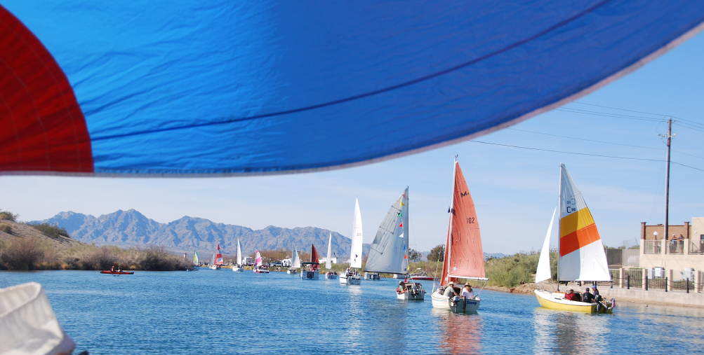
As we leave Bridgewater Channel to the north, the southerly wind picks up and we have a nice reach heading west. The cruising spinnaker, flying like a big genoa performs great. We get to pass a lot of other boats on the reach! One teases at us: "Showoffs!" The wind fills in nicely, and not much chop. As we approach the far end of the island, we need to turn upwind, so I gotta go forward to drop the chute - the one disadvantage of flying it off the forestay. The wind is blowing pretty hard! It is a bit of a struggle getting it down and into the bag. The nice thing about flying it off the pole is if all else fails, you can pull it down behind the main. OK, now I hank the jib on and get ready for the beat back to windward. But, then, we get a huge lift! Almost 100 degrees! Not sure, but maybe it is the way the air moves around the island and interacts with the land, and the heating and cooling in the desert. Anyway, we end up not having to beat back upwind - we are closehauled for a while, then we can reach. Then wind is just right, so we sail into the marina, up the channel, turn up between J and K docks, and turn into our slip - K12, as we drop the main. It's kind of fun sailing into the slip - a whole lot easier with two aboard, versus singlehanding. Our route is the cyan colored line on the map, except no, we did not sail across the land - my iPhone battery is dying, so my track recorder lost some parts of the track.
Back at the Nautical Inn: Here is a view of the cove, outside of our room:
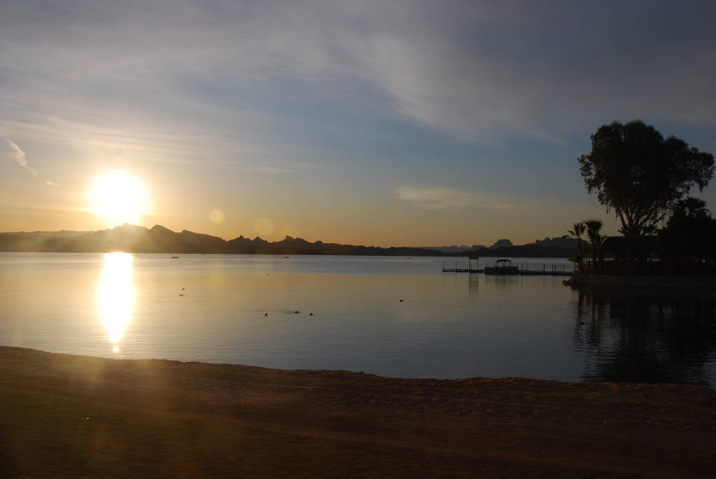
It's pretty neat: those with beach-able boats can just beach their boats right outside their hotel rooms! We decided to leave my boat in the marina, to avoid having to crank up the keel and pop up the rudder. The view at sunrise is equally spectacular:
Side note: We stayed in a cove suite, at the Nautical Inn. Sean negotiated some real deals for us - it was $79/night, HPCC special rate (the basic rooms were $59/night). As we were checking out, a woman was looking into booking some rooms for April. The cove suites were $299/night! Wow, did we get a deal. The high season begins on March 1st.
Sunday February 19: More seminars, closing ceremonies
It was a nice, calm day today. We didn't go sailing. There were seminars pretty much the whole day, and it was fun chatting with folks. In the evening, the conference center big screen had photos and videos of the week- it was a lot of fun reliving the week via photos and video, and sadly, saying goodbye to HPCC friends - with hopes to return next year.
Monday February 20: Sailed South, Copper Canyon, Standard Wash
Many HPCC-ers are departing today, or have already left. We are lucky - we get to head south and do some more exploring! On our way out, we see a few folks de-rigging at the ramp, and stop to chat for a while, share experiences, and good wishes. We leave the marina, and sail south - our destination is Standard Wash, to the south, about 8 1/2 miles south of the marina. It is partly cloudy, with light winds from the north. On the map near the top of this web page, it is the Magenta track.
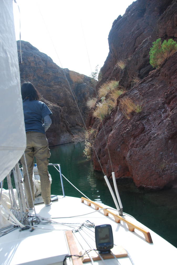
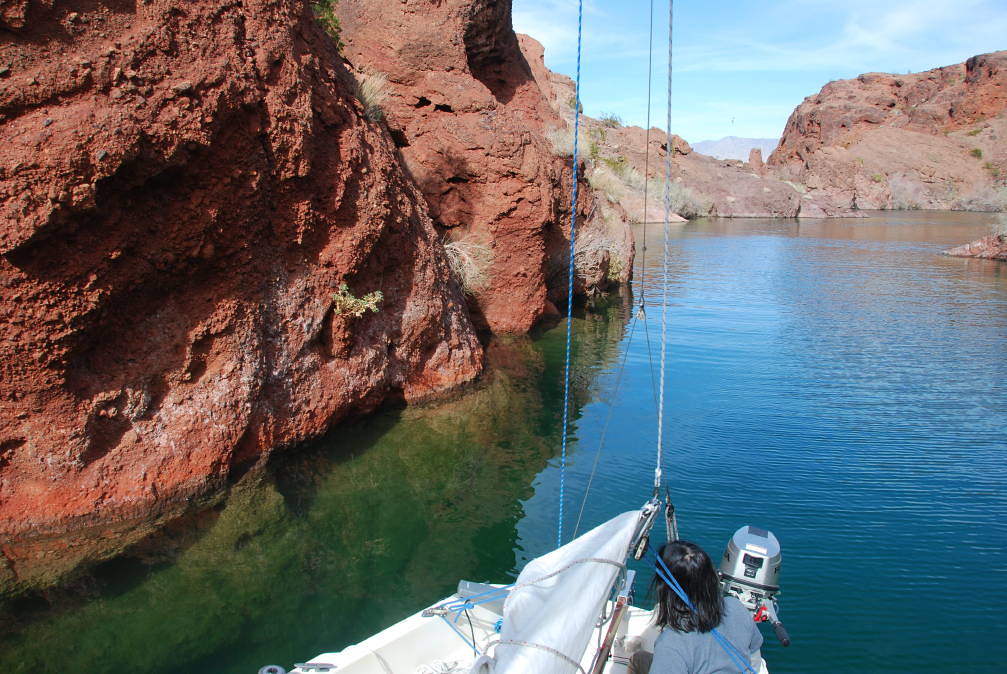
As are sailing south, we noticed a pontoon boat heading into a cove. We check the charts - it is named Copper Canyon. And it does go in a ways, with a turn or two, maybe a quarter of a mile. We are sailing, and the wind is light, and favorable, so we decide to sail into Copper Canyon. It is pretty neat - the sun off the red rocks, the shallows to avoid - we sail in to just about the end of the canyon, which has just enough water for us - about 5' at the end. Watch out for the submerged rock to the south!
At the end of the short canyon, we drop the sails and motor out - backwards. The canyon is shallow and a bit narrow, so I don't feel I have the room to turn around. The long shaft outboard backs the boat very well - my old short shaft would not have worked very well.
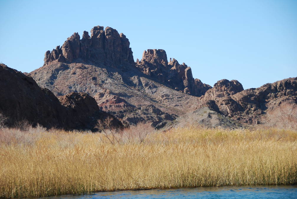
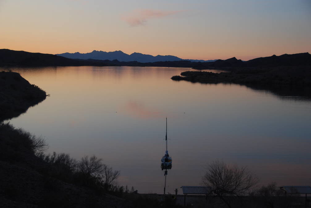
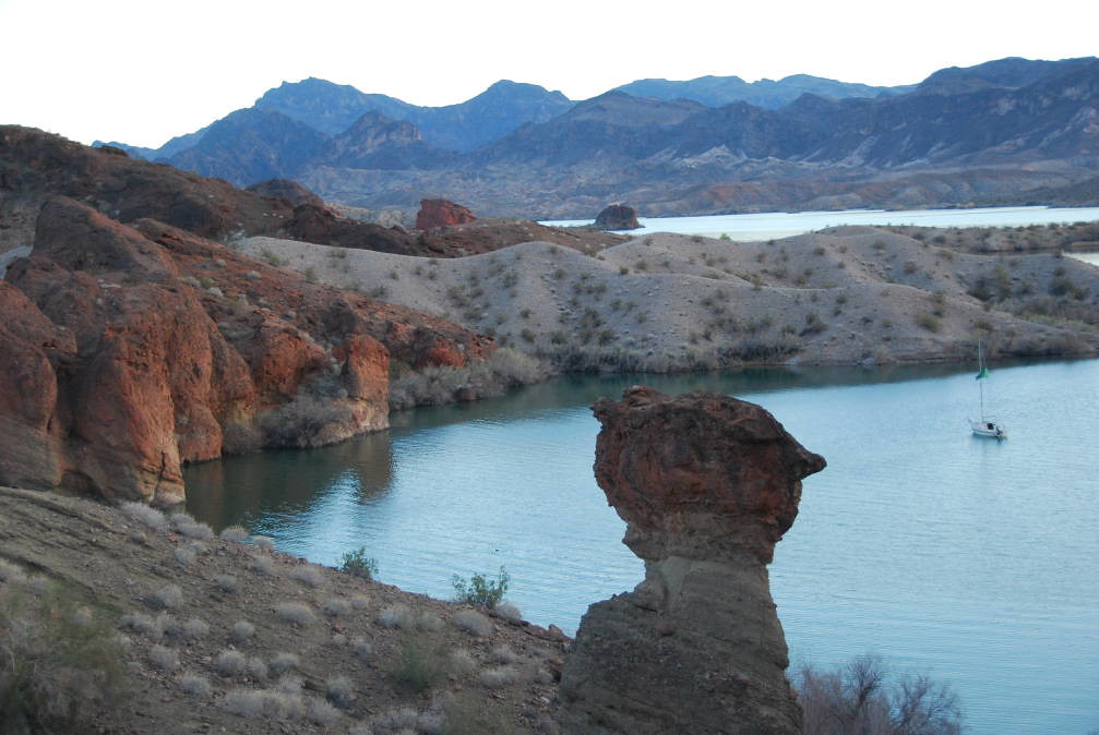
After our brief explore of Copper Canyon, we continue on south, slowly sailing to Standard Wash. The cove is deserted - we have the whole place to ourselves. We motor around, surveying the bottom, and decide to anchor out off one of the campgrounds, with a stern tie back to the convenient BLM provided post on shore. We arrive about sunset, and quickly inflate the kayaks and go ashore to take sunset photos. This is quite a picturesque area. This photo is looking northwest, toward Lake Havasu City.
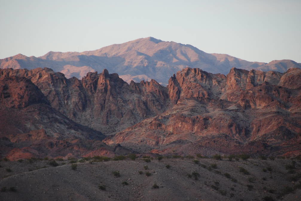
This is a view of the mountains to the east, with the setting sun providing the color.
The GPS recorded 9.3 NM today, mostly sailing, in light, northerly winds - hey at least it was going our direction! The night seemed quite cold - luckily, we had an extra sleeping bag to throw on top, and extra layers. I recall the forecast was to be in the mid 40's, so I guess it wasn't that cold, but with the days in the high 60's and low 70's, it sure seemed cold. Oh, and the stars and the night sky was beautiful! We are fairly far from civilization, so the sky is clear and no light pollution.
Tuesday Feb 21: Hike up Standard Wash to Slot Canyon and Slide, then sail to Balanced Rock Cove
Today, we take the hike up the Standard Wash, through the slot canyon, and up to the Standard Wash Slide. It was a beautiful, sunny, warm day. The hike description (http://www.golakehavasu.com/activities/ ... dard-wash/) indicates there is a twelve foot slide in the slot canyon. The trail from the campground leads us up the southeastern side of the wash - along the ridge, up high, so there are some pretty spectacular views of the surrounding landscape and good views up and down Lake Havasu. Side benefit: pretty good cell phone reception in places! On the map above, it is the orange route, from the Standard Wash anchorage to the Standard Wash Slide.
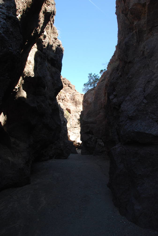
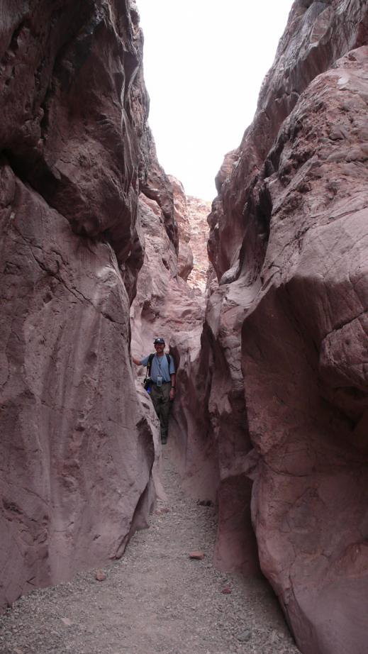
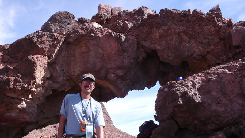
I guess we took the easy way in. From the trail description, the hike is 10 miles, and 4-5 hours. But this is from the road. By boat, the hike was a short mile and a half each way, and took us about three hours round trip (OK, we hike slow, and stopped a lot to take photos, and eat lunch). The normal hike is straight up the wash (e.g. where the water would run down), but since we were up on the southeast ridge, we stayed up high for a while, until we had to descend into the wash. We found a lot of very cool rock formations, arches, holes, wildflowers and more. It was a lot of fun exploring and taking photos. On this hike, we did not meet any other hikers - I guess this hike is far enough away, and this is the off season. The slot canyon here in Standard Wash was spectacular, but it wasn't as long or deep as the one between Balanced Rock Cove and SARA Park. Still, we did get to the twelve foot slide - Here is a photo of me standing next to it:
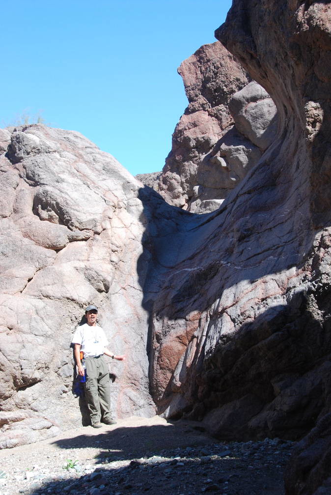
We climbed up the rocks on the northwest side, around the 12' slide, and found a nice shady place to eat our lunch. OK, I am a chicken, and I did not slide down the 12' slide - the last 5 feet was straight down! My sister, more adventuresome than I, took the slide down. She said it was fun, although not recommended for those with weak knees, since the last 5' or so was basically straight down!
After hiking back to the boat, we weighed anchor, cleaned the mud off, and sailed out of the anchorage - without using the outboard. The bay off Standard Wash is very large and free of obstructions, and the wind was good, so we had an easy sail out. Its good practice too - be prepared with sharp sailing skills in case of an engine failure. Winds were light, about 5-10 kts from the north, so we beat slowly northward, toward Balance Rock Cove. We were there earlier in the week, but we did not have a chance to hike to The Arch, which is just above the slot canyon. The wind was fairly steady, and even though we had to beat, it was a nice sail. As the winds picked up, we were able to make 4-5 knots. As we turned into Balanced Rock Cove, the winds were just right, so we sailed into the anchorage, dropped and set the anchor - without the motor. So no outboard usage at all today! OK, I kind of botched it a bit, and I think I got the anchor rode wrapped around the swing keel! But a bit of patience, tugging and steering, and we got it untangled. We anchored in about 13' of water. Again, we get there just about sunset - seems to be a pattern! Again, the sunset off the rocks bring out the color. We go ashore for some photos use the land head, and pay our fee. Note: It is very nice that the BLM provides land heads at the campgrounds - I don't have to dump the porta potty as often! Here is a photo looking southwest - and you guessed it - that is the Balanced Rock!
My sister commented, someday, when erosion causes the rock to fall, then they'll have to rename the cove! Still, it is a beautiful cove, and a nice anchorage. The GPS reports that we covered 8.7 NM today. While we were on shore exploring, we looked up the wash and toward the crack, and hey, there's the Arch! For us who are used to hiking in the forest, this is kind of a new experience - being able to actually see your destination, and a lot of views all along the way.
Wed Feb 22: Hike up to The Arch, then sail back to Havasu Marina
Woke up to another beautiful, sunny day. I'm from western Washington, and not used to this - especially in February! I can see why people come here in the off season. It wasn't quite as cold last night. Today, we hike from Balanced Rock Cove to Arch Rock. Here is the hike description: http://www.golakehavasu.com/activities/ ... rock-loop/

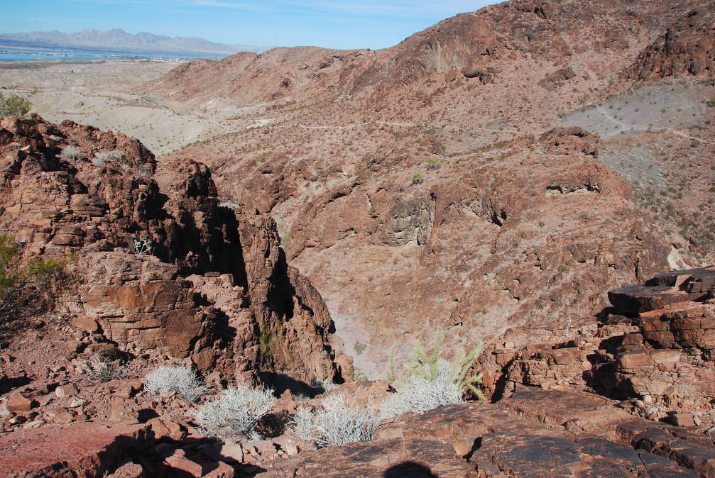
Again, the description is assuming you are coming from the road. It's kind of neat to come from the water. We spent a bit of time this morning in the kayaks, exploring the cove, poking around the various rock formations, inlets, and up the wash. Then, we go ashore and start our hike. The description is pretty good - we hike up the wash, and we find the painted rock marker by the large bush, indicating the trail up to the Arch. The painted rock is just before the slot canyon (coming from the water) - just like the description. We hike up the trail, which goes above the slot canyon. We were trying to get a good view down into the slot canyon, that we ended up taking the wrong trail, and ended up hiking up a ridge just east of the Arch. But, it was well worth it, and we were rewarded with some great views. Here is one looking north, towards Lake Havasu City. You can see the Island, and the resorts, and the Marina, beyond the wash.

So we ended up hiking up a lot more than necessary. But we were rewarded with good views down the slot canyon too:
Again, one nice thing about desert hiking is you can see for miles and miles and miles (assuming the weather is good). So we surveyed our position, and found a way down off the ridge, and eventually got to the Arch. Here is a view from the 'back', looking northwest - most people don't see this side.
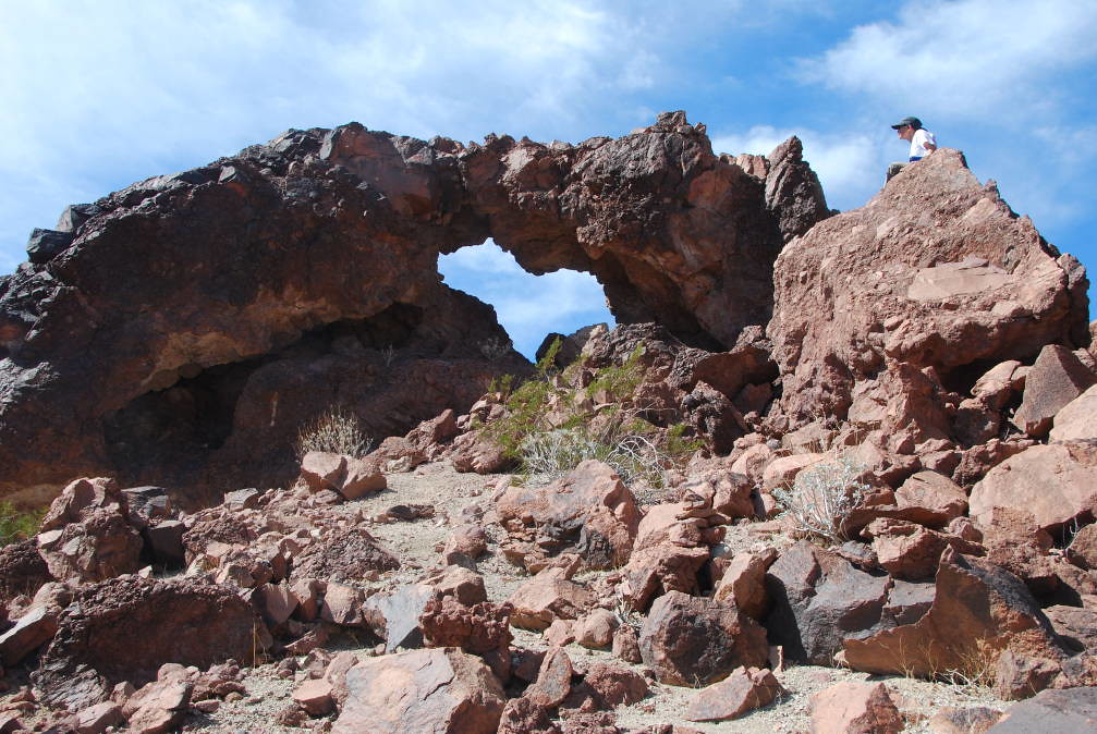
I guess I am sounding like a broken record, but the views are fantastic! The GPS agrees with the hike description, and the topo map - The ridge we hiked up was at about 1000 feet, and the arch is at 810 feet, so we descended the 200 feet and got to the arch. We even found a geocache at the Arch, and signed the guest book inside.
After eating lunch and enjoying the views, it was time to head back to the boat. This time, we hiked the direct route, down the trail to the painted marker rock, joined the wash trail, and hiked back to the boat. We tried sailing off the anchor again, but the cove is a bit smaller, and the wind was against us, and, I guess I don't have that much skill (a good humbling experience) so I have to start the outboard to keep from getting blown into the rocks. After motoring out of the cove, we set the sails and beat back toward the marina. We sail by Copper Canyon. There are three powerboats milling about, and the wind is not right, so we sail by. We had a nice visit a few days ago. As we sail north, we see some fellow HPCCs from Washington, sailing south. We wave, and send our greetings as we pass. As we sail back toward the marina, we notice the Nautical Inn's cove is empty - no sailboats! How sad. Not until next year, I guess. Actually, there are no boats at all! I guess it is still the low season. We make it back to the marina - before sunset! Good, we need to pull out, drain the bilges, clean the boat (make sure we are not moving invasive species), and prepare for the long drive home. We end up getting things buttoned up after dark, and head west. We drive into the night, and stop after we get to I-5.
Thursday Feb 23: Driving: Leave for home
Another driving day, but we are stopping by the SF Bay area to see our Mom for a few days. We drive up I-5, and take Highway 152, Pacheco pass, which goes right by San Luis Reservoir. Originally, I was hoping to spend a day sailing on San Luis Reservoir. But, they are quite strict about invasive, and I am not sure if they require a quarantine period - some places require the boat to be dry for 5 days! So we'll pass this time. San Luis Reservoir is special to me - it was one of the first places I got to learn to sail in significant winds, on a 12' Korale sailing dinghy. Our family has spent time at the campground on the San Luis Reservoir, and I have a lot of pleasant memories sailing in calm, and rough, blowing like mad conditions with my Dad and my sister. Friday is a visit with Mom day, and relaxing day.
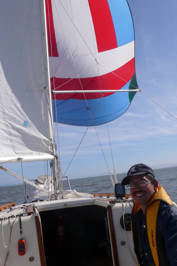
Saturday Feb 25: Sailing in San Francisco Bay
Mom said: Go Sailing! So today, we get to sail on San Francisco Bay! We launched at the Oyster Point Marina, which is pretty near the San Francisco Airport. I didn't want to fight the mess and lack of parking at any of the ramps closer to San Francisco. But we got a late start, so no sailing under the Golden Gate Bridge today. Maybe another time. The winds were from the west, 10-15 knots, and increasing in the afternoon. At first, the winds were light, although it was a bit choppy - a good reminder we aren't on a lake! There is a distant view of the San Francisco skyline in the background:

There were a few other sailboats out for a sail - all of them significantly larger. We had to get a good run in, so we headed southeast and put up the spinnaker. What a run! It was great. Making 5+ knots, with peaks into the low 6's.
As we approach the San Mateo Bridge, it is time to drop the chute and start the beat back to the marina. As promised, the winds are picking up - heading to the 20's, with whitecaps forming. Oops, I guess we probably should have turned around sooner. We get set up for the long beat - put up the jib, put a reef in the main, raingear on, and head up into the wind. The weather is still nice, and the views are good, but the chop and wind requires careful steering to keep us moving at a reasonable speed. One bit of luck - the 1.5 knot tide is going our way, so we are making about 5 knots. After a couple hours of beating into the wind, and getting sprayed with salt water, we finally turn into the marina, and pull out. Hey, and it is before sunset! I guess I didn't plan that one very well! Now the boat, rigging, lines and sails have had a really good salt water soaking. We get back to my mom's after dark. The next day, we rinse down the boat and gear. Monday, we head north, back to Washington. We are trying to make it over the Siskiyous (I-5 mountain passes, between Oregon and California) before an approaching storm, so we drive like mad, staying under 55 (ok, maybe 60 at times) up I-5. We are blessed with a very nice day, and clear skies. It is hard to believe a storm is approaching, but we don't want to get stuck, so we drive on. We manage to make it to Springfield, OR before turning in for the night. The next day, we drive on, and yes, it rains. We feel fortunate to have been able to make it before the storm. Welcome home to the rainy northwest. But, we did have a great couple of weeks in the sunny desert.
Overall, the trip was well worth it to me. I had a great time, sailing, hiking, and meeting folks. Some of the locals tell me the wind this year was especially good. I hear normally it is lighter. The drive was, well, long, and I did end up spending about $1000 on gas (Full sized van, 12 mpg, including a 240 mile detour to visit my Mom in the SF Bay Area). But the sailing was great, the weather was great, and the people were great - it was a lot of fun meeting fellow trailer sailors from all over, sharing experiences, and just talking about boats. So for me, it was well worth it, although if you want to race, the event wasn't about racing. The dates for HPCC 2013 have already been set: Feb 11 through 17, 2013. I have it on my calendar and hope to be able to go again. Hope to see a few more SJ21's next year!
Jeff D, #2208
http://www.sailhavasu.com
More event photos at:
My Photos: http://www.flickr.com/photos/sailhavasu ... 449207007/
Other HPCC-er's photos: http://www.flickr.com/photos/sailhavasu ... 240797431/
A few videos/slide shows of the event:
http://www.youtube.com/watch?feature=pl ... zHcBYq3coM
http://www.youtube.com/watch?v=y8rT0byP ... re=channel
http://www.youtube.com/watch?v=C4GI6mln ... re=channel
http://www.youtube.com/watch?v=K1_3AnCR ... e=youtu.be
http://www.youtube.com/watch?v=P_7POx9s ... e=youtu.be
